How To Choose The Right Surveying Equipment For Your Project
Posted by Matt Lacey on

If you’re a senior engineer or independent surveyor and you’re involved in a project, you need surveying equipment. However, deciding which models to use can be a challenge.
This post is here to help. We discuss the factors that go into choosing appropriate survey equipment.
What Level of Accuracy Do You Need?
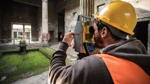
Total stations are built with different levels of angular accuracy. The super high precision 1” is generally required for monitoring tasks but is not necessary for most site engineers, who can use a 5” instrument. A total station will also generally give a better positional accuracy than a GNSS receiver. Having said that, a GNSS receiver has the advantage of taking its position from satellites, so operators can immediately start working in national grid coordinates. Be careful when surveying boundaries to check that you’re using the right national grid because that has changed over the decades and may not be the same as it was.
How Big Is Your Team?
You’ll also need to factor in team size. Many older units, for instance, require two or more people for proper operation – one person to direct the unit, and another to act as “spotter.” If you work in a team, that’s fine, but if you are working alone, it’s a problem.
Fortunately, you can now rent modern units that only require the presence of one person.
Manual total stations require two people to operate - one to hold the prism, and one to aim the total station. But when you’re working with a robotic total station, however, the user can walk around hands-free, with the total station following them robotically, allowing the operator to get on with the task at hand. Despite the fact that some contractors will require operators to always work in pairs, lack of manual aiming means increased productivity.
What Kind of Timeline Are You Working With?
Timeline is another key consideration. Construction projects often go over budget because of changing priorities, forcing surveyors to change or adapt their plans.
In the past, the speed at which surveyors could react to these shifts in direction was limited. However, newer equipment can speed up the process, because it both requires fewer employees and can crunch the numbers faster.
Either with the modern x-pad software, you can save time spent running between the field and the office because of the advanced CAD functionality built into the software. The time savings really add up.
What Is Your Project?
The type of project you want to undertake will also determine which survey equipment to use. Currently, the most popular types of land surveying tools are 3D scanners, total stations, GPS/GNSS, and ground penetrating radar. You should always seek advice on the specifics of your project as to what is the most useful and if you don’t already own it, you can easily hire from Survey Tech.
What Product Would Suit Best?
Lastly, you’ll need to consider the specific product that would suit you best. Survey Tech can advise on surveying equipment and their uses.
Image Source: BenchMark
